Discover the Valley Quests in Cornish (2021 No. 12)

If you’re not familiar with Valley Quest, it is totally worth your while to explore this fun activity to learn more about Cornish and the greater Upper Valley towns. Valley Quest is a collection of treasure hunts that showcase the natural gems and cultural heritage of the Upper Valley. Children, families, adults, and visitors to Cornish have all enjoyed looking for the Valley Quest locations, which are managed by volunteers. The quests take from 20 minutes to 2 hours, and information about the program is on the Vital Communities website. LINK. Read on for the quests located in Cornish, many of which were created by students at the Cornish Elementary School. Click on the title of the quest to be taken to the Vital Communities website for details and directions.

Cornish Recreation & Education Area (CREA) – 45 minutes. Easy nature trail journey through forest, wetland, and field communities. Bring binoculars, compass, field guide to birds & flowers.

Cornish Flat – 45 minutes. Easy walking tour to discover the rich legacy of the historical buildings of Cornish Flat. Did you know Cornish Flat once had a jail and was a bustling area for town commerce? Bring a compass.

Saint-Gaudens – 1 hour. Easy nature trail walk amidst outdoor architectural and historical exhibits designed around the elegant studio and classic gardens of one of America’s greatest sculptors. Bring a compass, entrance fees charged (National Historic Site).

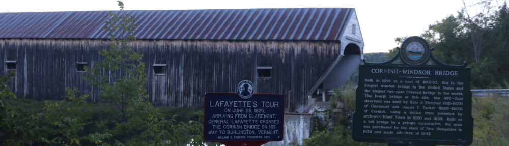
Blacksmith Bridge – 20 minutes. Moderate walk on to visit one of James Tasker’s restored covered bridges that cost $873. to build in 1881. Bring a compass.

Blow Me Down Mill – 20 minutes. Easy walking trail through Cornish history to discover an historic mill near Saint-Gaudens National Historic site.

Trinity Church – 15 minutes. Visit the gracious and stately old Trinity Church, on the National Register of Historic Places, and the graves of the many of Cornish’s first settlers.

Scenic Roads & Scenic Views in Cornish (2021 No. 11)

Cornish has many scenic roads and viewpoints, with some roads being specifically designated as ‘scenic’ by the Selectboard. Any road in Cornish, other than a Class I or Class II highway, may be designated as a scenic road with a petition signed by 10 people who are either voters of the Town or who own land which abuts the road, and approval by the voters at any annual or special meeting.

Currently, the following roads have been designated as “scenic” at previous Town meetings:

  • Lang Road
  • St. Gaudens Road
  • Whitten Road
  • Gap Road
  • Paget Road
  • Platt Road

When you drive along these roads (except in mud season!), the beautiful forestlands, historic stonewalls, and scenic viewpoints are evident.

After a road is designated as “scenic”, any repair, maintenance, reconstruction, utility, or paving work done by the state or the Town of Cornish may not involve the cutting, damage or removal of trees, or the tearing down or destruction of stone walls except with the prior written consent of the Cornish Planning Board. One exception to this is that trees may be removed by the Cornish Road Agent with written permission by the Selectboard or a public utility company may remove trees for safety reasons and/or to restore power.

The Connecticut River Byway, a tri-state scenic drive in Massachusetts, Vermont and New Hampshire, follows the Connecticut River through Cornish along Route 12A. Cornish is also included in the Connecticut River Heritage Trail, a 77-mile driving/biking/walking tour of history and architecture in Claremont, Cornish, Plainfield, Windsor and Hartland. The tour guide brochure was published in 1999 by the Connecticut River Joint Commissions.

Almost every road in Cornish has a place along it that offers a beautiful view. Some examples include looking west toward Mt. Ascutney from the top of Dingleton Hill and Lang Roads, along route 12A looking over the Connecticut River at the Cornish-Windsor Covered Bridge, looking up the valley from route 120 in front of the Cornish Flat Fire Station, along Cornish Stage Road looking toward lush farmlands, verdant fields, and wetlands, and along East Road looking toward the distant hills and forests.

Guidelines for Developing Scenic Roads

Scenic Road Petition

Map of Scenic Roads & Viewpoints

Know How to Spot Invasive Plants in the Landscape: Multiflora Rose & Garlic Mustard (2021 No. 10)

How does a plant earn the label ‘invasive’? According to the Ecological Landscape Alliance, invasive plants disrupt ecosystems by overtaking native plants, potentially limiting or eliminating food sources for pollinators and animals. Invasive plants can also alter soil chemistry, making it more difficult for native plant species to flourish.

Multiflora rose is a large perennial shrub that forms dense stands of impenetrable thickets that can grow up to 10 ft tall, displacing native vegetation. It can also grow as a climbing vine reaching heights of 25-30 feet, and forming large clusters of fragrant white or pink flowers that bloom June to July. Like other roses, it forms small red pulpy fruits called hips, which may be eaten by birds. It can be distinguished from native roses by its long arching stems and numerous small white flowers or hips depending on the season.

Multiflora rose is highly aggressive and colonizes old fields, pastures, roadsides, open woodlands, and forest edge habitats. It is most productive in sunny areas with well-drained soils. Multiflora rose is used for cover during all times of year by cottontail rabbits, white-tailed deer, pheasants, and mice, and it is a preferred nesting site species for gray catbirds. View photos of multi-flora rose.

Garlic mustard generally has a single flowering stem and emerges early in the spring in our area. It is identified by crushing the stems which releases the scent of garlic, hence its name. The flowers are white with 4-petals and seeds are produced beginning in May. Each seed pod contains between 12-19 seeds, and the number of pods per plant can vary greatly from 1 to more than 200. Seeds remain viable for up to 6 years,

Garlic mustard can have a wide range of negative impacts to both the environment and to wildlife. When their populations grow unchecked, they can outcompete native species by robbing them of light, nutrients and soil moisture. Their rooting systems and decaying leaf litter release chemicals into the soil, which inhibit the germination and growth of native plants. Garlic mustard can also negatively affect soil fungi essential for nutrient uptake by our native hardwoods. In addition, Garlic mustard has a toxic effect on the development of butterfly eggs when laid on the foliage or stems. View photos of garlic mustard.

Your Public Lands: Cornish Recreation & Education Area (CREA) (2021 No. 9)

CREA is the story of a group of Cornish residents who started with a small idea which then grew into a Town resource of many uses. In 1971 the Town was in need of a fire pond with close access to the fire station. Anne Davidson generously deeded 1.2 acres of land to the Town for $1. With the help of the Sullivan County Soil Conservation Service, a fire pond with an Island for wildlife, was dredged next to the fire station. Located right across from the school the pond soon became a nature study area for students.

Soon talk started of expanding the area to ten acres to include an extensive recreation and education area. Then the idea of purchasing the entire 76 acres of field, forest, streams and wetlands was born. In 1982 the Cornish Conservation Commission proposed using money from the Cornish Fair Association, Conservation Commission funds and a State grant to purchase the property. Unfortunately the Town was unable to get the State grants but the enthusiasm for the project did not wane.

At the 1983 Town meeting Myron Quimby moved and Jim Lukash seconded a motion to appropriate the sum of $31,000 for the purchase of the 76 acre Anne Davidson property abutting Town House Rd and Parsonage Rd. Rickey Poor spoke in favor of the motion and further explained who would benefit from the purchase and where the different monies would come from. She explained that the Conservation Commission would contribute $10,000; Anne Davidson agreed to donate $10,000 and that the Conservation commission would apply for a Grant from the NH Department of Resources and Economic Development (DRED) which, if approved, would eliminate the Town from having to pay $31,000. A private citizen also pledged $10,000 for the purchase if the grant was not approved. Ellen Ballard, Bunny Barker, Paul Queneau and Ruth Rollins also spoke in favor of the motion that was then passed by a vote of 156 yea’s, to 4 no’s.

The importance of the acquisition of the CREA land was underscored by the comments made by Bunny Barker comparing the CREA land with Central Park in New York. “The concept of preserving land for recreational and educational use is as sound here as it was in a growing New York”. The grant from the State was approved so the land was purchased without the $31,000 expenditure voted at the 1983 Town meeting. Also in 1983 a $10,000 anonymous donation was made for the development of sports facilities and pledges of $10,000 of donations were made for the purchase and/or conservation education.

Check out the CREA Management Plan